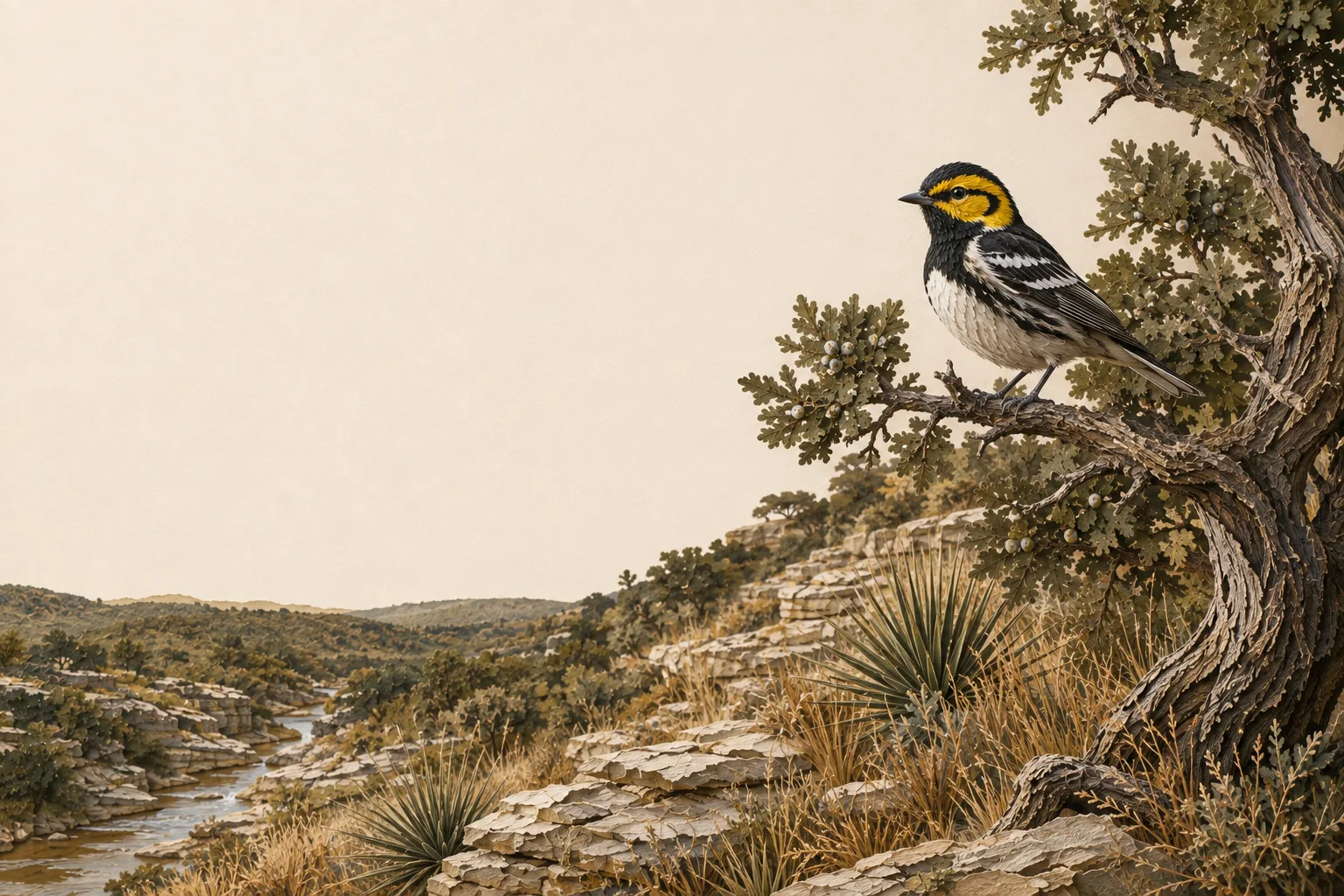
Illustrated Edwards Plateau limestone creek, Ashe juniper and Golden-cheeked warbler.

Edwards Plateau Ecoregion

Tom Green County Wildlife Exemption

How to get - and keep - a 1-d-1 wildlife management valuation on Tom Green County land: deadlines, the appraisal district, and the practices that fit this part of Texas.

Ecoregion
Edwards Plateau
County seat & CAD
San Angelo, Texas
Application window
January 1 – April 30
Core requirement
Form 50‑129 + PWD‑885 · 3 of 7 qualifying practices annually

The wildlife exemption in Tom Green County

Tom Green County sits in the heart of the Edwards Plateau - limestone hills, live oak savannah, and spring-fed creeks - the heart of Texas wildlife management. For landowners here, the 1-d-1 wildlife management valuation is the most practical way to keep agricultural-level property taxes without running livestock.

The Edwards Plateau - the Texas Hill Country - is a limestone tableland of live oak and ashe juniper savannah, cut by spring-fed creeks and steep canyons. Decades of overgrazing and juniper encroachment have degraded native grasslands here, which is exactly why wildlife management practices like brush control and native grass restoration carry so much weight with appraisal districts in this region.

The Edwards Plateau supports some of the densest white-tailed deer populations in North America - often exceeding one deer per 8–10 acres - which makes census counts and habitat management especially meaningful here. Typical target species for Tom Green County plans include white-tailed deer, Rio Grande turkey, bobwhite quail, black-capped vireo, golden-cheeked warbler, and a wide range of native songbirds and pollinators. The recurring habitat challenges - juniper (cedar) encroachment, overbrowsing by high deer densities, and declining spring flows - are what a good management plan turns into qualifying work.

On the ground in Tom Green County

San Angelo sits on the Concho river system in country that shifts quickly from city edge to mesquite, prickly pear, dry grass and old sheep range. West and south of town, some ranches feel almost Edwards Plateau-like; elsewhere the landscape opens toward the Rolling Plains. Here, wildlife management can use that transition rather than fight it: water, erosion repair, selective brush work, native-grass recovery and repeatable census routes all fit. What matters in Tom Green County is a plan that can read like Concho-country range management, not a generic central-Texas ranchette.

Tom Green County reads as Edwards Plateau habitat on the ground, but TPWD assigns it to the Rolling Plains wildlife-use appraisal region for reduced-tract acreage rules - two different maps, and the legal one controls the numbers below.

Is there an acreage minimum in Tom Green County?

Did the tract get smaller since January 1 of last year?

No ➔

There is no wildlife acreage test in Tom Green County at all. Whatever the size, file Comptroller Form 50‑129 with a PWD‑885 plan. A 7-acre tract that already carried 1‑d‑1 (ag exempt) and was never split can convert with no penalties.

Yes ➔

The Tom Green County appraisal district has not published its exact figure. However, the legal minimum land requirement for this county in the Rolling Plains region is between 25–50 acres (96–98%). If your acreage is inside of this range, we recommend to file the plan either way; the county will apply whatever they adopted.

Try It Out Risk-Free

See how Tom Green County compares: minimum acreage for all 254 Texas counties →

How it works here

Tom Green County follows the statewide 1-d-1 framework (Texas Tax Code §23.51(7)); the local variables are your appraisal district's filing habits and the Edwards Plateau intensity standards:

  • Start from an existing ag or timber valuation. Wildlife management is a conversion of qualified open-space land - check eligibility if your status is unclear.
  • File a wildlife management plan (TPWD form PWD‑885) with the Tom Green County appraisal district, attached to Comptroller Form 50‑129, between January 1 and April 30. What goes in the plan →
  • Perform at least 3 of the 7 practices each year at Edwards Plateau intensity levels - see the local examples below.
  • Document everything - dates, photos, quantities. When the chief appraiser requests an annual report (PWD‑888), you'll answer with records, not recollections.
  • No minimum acreage applies unless your tract got smaller since January 1 of last year. If it did, Tom Green County's figure is covered above - the district picks one number for the whole county, and the plan is still the application either way.

The 7 practices, Edwards Plateau-style

These are the kinds of activities appraisal districts in the Edwards Plateau recognize as real management - your plan picks at least three. The Edwards Plateau region guide covers the species, habitat problems and intensity standards behind them.

1

Habitat control

Selective cedar (ashe juniper) removal to release native grasses, prescribed burns to restore oak savannah, and re-seeding with natives like little bluestem and sideoats grama.

2

Erosion control

Building brush berms on caliche slopes, gully plugging in drainages, and re-vegetating creek banks with switchgrass to slow runoff on thin limestone soils.

3

Predator control

Trapping feral hogs, controlling brown-headed cowbirds to protect nesting songbirds, and managing raccoon populations around turkey nesting areas.

4

Supplemental water

Installing wildlife water guzzlers on dry uplands, converting old livestock troughs with wildlife ramps, and protecting spring flows with fencing.

5

Supplemental food

Planting small food plots of oats or clover, managing native browse through rotational deer harvest, and supplemental protein feeding during summer stress periods.

6

Providing shelter

Retaining strategic cedar thickets for screening cover, building brush piles from cleared juniper, and installing nest boxes for cavity-nesting birds.

7

Census counts

Fall spotlight surveys on established routes, trail camera surveys at a rate of roughly one camera per 100 acres, and browse utilization surveys on key plants.

Filing & the appraisal district

DateWhat happens in Tom Green County
January 1Valuation date - land is judged on its use and qualification as of this day.
Jan 1 – Apr 30File Form 50‑129 with your PWD‑885 plan at the Tom Green County appraisal district (San Angelo).
After Apr 30Late applications accepted until the appraisal roll certifies, with a 10% penalty on that year's savings.
On requestThe chief appraiser may require a PWD‑888 annual report - many districts ask annually. Keep logs so the answer is one click away.

The Tom Green County appraisal district is headquartered in San Angelo. For current mailing addresses, phone numbers, and any locally adopted wildlife-use ratio, use the Texas Comptroller's county directory - and confirm details before filing; districts occasionally adjust procedures year to year.

The cost of letting it slip

Losing qualification means market-value taxes going forward - and if the land's use changes to non-agricultural, rollback taxes: the previous three years of tax savings, recaptured in one bill. On typical Tom Green County acreage that's easily five figures. How rollback works →

Tom Green County questions

Tom Green County wildlife exemption FAQ

The questions Tom Green County landowners ask most - answered against this county’s appraisal district and the Edwards Plateau standards its plans are judged by.

How many acres do you need for a wildlife exemption in Tom Green County?
For most tracts, there is no minimum at all. Tom Green County applies no acreage test to wildlife management use unless your tract was reduced in size since January 1 of the preceding year. If it was, the Tom Green County appraisal district applies one figure it has adopted from the band its TPWD wildlife appraisal region carries - Tom Green County sits in the Rolling Plains region, whose legal minimum land requirement for this county runs 25–50 acres (96–98%). If your acreage is inside of this range, we recommend to file the application either way; the county will apply whatever they adopted.
What is the wildlife exemption filing deadline in Tom Green County?
April 30. The window opens January 1 and closes April 30 - file Comptroller Form 50‑129 with a TPWD PWD‑885 wildlife management plan attached at the Tom Green County appraisal district in San Angelo. Miss it and the district still accepts a late application until the appraisal roll certifies (typically mid-July), but with a 10% penalty on that year’s tax savings. One trap catches new owners every year: buying land that already holds the valuation does not carry it over to you - you have to file your own application.
Do I need an existing ag exemption to get a wildlife exemption in Tom Green County?
Yes. Wildlife management is a qualifying use within the 1-d-1 open-space valuation, not a separate exemption - so the land has to already carry an agricultural or timber productivity valuation on the day you convert. If it does, converting changes the qualifying activity and nothing else: the productivity value carries over from your previous ag category, so your tax bill does not move. If the land lost its valuation, you would requalify the ordinary way first - agricultural use for 5 of the preceding 7 years - and then convert. The conversion playbook →
Which wildlife management practices qualify in Tom Green County?
Any three of the seven named in Texas Tax Code §23.51(7): habitat control, erosion control, predator control, supplemental water, supplemental food, providing shelter, and census counts. The list is statewide, but the standard you are judged against is regional - Tom Green County is Edwards Plateau country, so the Tom Green County appraisal district expects work sized to Edwards Plateau intensity levels and aimed at the problems that actually limit wildlife here: juniper (cedar) encroachment, overbrowsing by high deer densities, and declining spring flows. Habitat control, supplemental water, and census counts are the most common opening three. See what each one looks like here →
What species should a Tom Green County wildlife management plan target?
Whatever you name, it has to be indigenous - Texas Tax Code §23.51(7) qualifies land used to sustain a breeding, migrating, or wintering population of native wild animals, and that is the species test that actually decides qualification. In the Edwards Plateau, plans are usually built around white-tailed deer, Rio Grande turkey, bobwhite quail, black-capped vireo, golden-cheeked warbler, and a wide range of native songbirds and pollinators. The Edwards Plateau supports some of the densest white-tailed deer populations in North America - often exceeding one deer per 8–10 acres - which makes census counts and habitat management especially meaningful here. Introduced species are the common trap: exotics like axis deer or blackbuck may live on the property, but managing for them (alone) earns you nothing toward your three practices - so confirm every species you name in the plan is native to Texas before you file.
Does Tom Green County require a PWD-888 annual report every year?
The chief appraiser may require one whenever they ask - that is the statutory standard, and many Texas districts ask annually or on a review cycle. The practical answer is to assume it is coming: keep dated records, photos, and quantities for every practice as you go, and the report is a formality instead of a scramble. Landowners rarely lose a valuation because the work was not done; they lose it because the work could not be proven. What a strong PWD‑888 looks like →
Will switching from cattle to wildlife trigger rollback taxes in Tom Green County?
No. Rollback under Texas Tax Code §23.55 is triggered by a change to a non-agricultural use - developing, paving, or subdividing the land. Moving from grazing to wildlife management is a change of use within 1-d-1, so the valuation continues uninterrupted and no recapture is owed. What does carry risk is letting the land go idle: land quietly used for nothing agricultural can be treated as having changed use. A documented wildlife plan is precisely how you stay out of that gray zone. How rollback works →
Who approves the wildlife exemption in Tom Green County - TPWD or the appraisal district?
The appraisal district. The Tom Green County appraisal district’s chief appraiser reviews your Form 50‑129 and PWD‑885 plan and decides whether the land qualifies, the same as for any agricultural application. Texas Parks & Wildlife publishes the forms and the ecoregion guidelines your plan should match, but it does not approve individual properties and has no vote on your valuation. The district is headquartered in San Angelo; current contact details are in the Texas Comptroller’s county directory.

Looking for the statewide picture? The full Texas wildlife exemption FAQ covers eligibility, plans, practices, reports, and rollback in depth.

The Edwards Plateau counties closest to Tom Green County - same ecoregion, same intensity standards, and largely the same ground:

Rio Grande wild turkey and northern bobwhite quail among native Texas grasses and limestone

Protect your Tom Green County valuation.

Bring your previous report and field records. Keep this year’s practices, county feedback, and next PWD‑888 together.

No credit card required · Start free, upgrade when ready